
Jess and Shyler
Jess and Shyler
Hiking Guide
The listed hikes can be found on All Trails. Please note that cell service is unreliable for many of these trails. It's a good idea to download your offline map ahead of time. We listed everything in order of difficulty (easy to hard). You'll need to enter RMNP for all of them.
Sprague Lake Loop
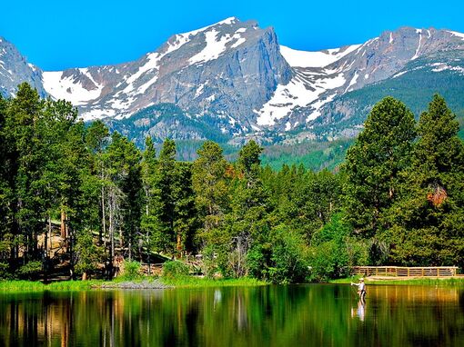
Difficulty: Easy. Length: .8 miles. Elevation Gain: 36 ft. Type: Loop. Location: RMNP, so you'll need a park pass. Read the Things to Do tab for more information on how to do that. More Information: Check it out. Kid friendly.
This is a trip around Sprague Lake (elevation 8,700 ft). There are benches to sit or watch folks fishing in the lake. You'll get great views of the surrounding peaks and the Continental Divide from the lake. Boardwalks and bridges have been built over the marshy western side of the lake. Sprague Lake is named for a guide and lodge owner who built the lake before Rocky Mountain National Park was established in 1915. This hike is also popular in the winter.
Alberta Falls Trail
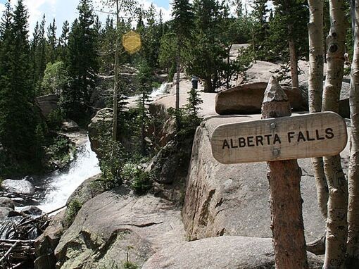
Difficulty: Easy. Length: 1.6 miles. Elevation Gain: 226 ft. Type: Out and Back. Location: RMNP. More Information: Check it out. Kid friendly.
Chasing waterfalls? Look no further. This family-friendly hike takes you to the stunning Alberta Falls from Glacier Gorge Junction trailhead. You'll get great views of the surrounding peaks. This scenic hike is also one of the most popular in Rocky Mountain National Park.
The trail starts at Glacier Gorge Junction trailhead, and heads south, paralleling the creek. The trail passes several aspen groves that are gorgeous during the fall. After less than a mile, the scenery opens up onto a rock ledge overlooking Glacier Gorge. From there, the trail parallels Glacier Creek for the rest of the way to the falls. As you approach, you won't be able to miss the sound of Alberta Falls as it roars through a granite chute. The rock slabs surrounding the falls are a great place to explore and picnic.
Emerald Lake Trail
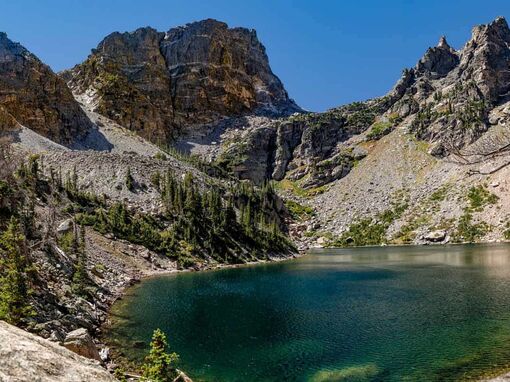
Difficulty: Moderate. Length: 3.2 miles. Elevation Gain: 702 ft. Type: Out and Back. Location: RMNP. More Information: Check it out. Kid friendly.
Generally considered a moderately challenging route, it takes an average of 1 h 39 min to complete. This is a very popular area for fishing, hiking, and snowshoeing, so you'll likely encounter other people while exploring. Poles and spikes are helpful if it's icy. The trail is open year-round and is beautiful to visit anytime. You'll need to leave pups at home — dogs aren't allowed on this trail.
Gem Lake Trail
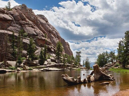
Difficulty: Moderate. Length: 3.2 miles. Elevation Gain: 987 ft. Type: Out and Back. Location: RMNP. More Information: Check it out. Kid friendly.
The last stretch is all stairs. Get to know this 3.2-mile out-and-back trail near Estes Park, Colorado. Generally considered a moderately challenging route. This is a very popular area for hiking, so you'll likely encounter other people while exploring. The trail is open year-round and is beautiful to visit anytime. You'll need to leave pups at home.
Lake Haiyaha Trail
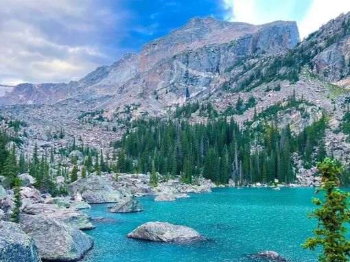
Difficulty: Moderate. Length: 4.0 miles. Elevation Gain: 846 ft. Type: Out and Back. Location: RMNP. More Information: Check it out. Kid friendly.
Check the weather reports before you take this one on. Lake Haiyaha is a popular destination within Rocky Mountain National Park. It is known for its clear, beautiful water where trout are often visible. The lake is surrounded by boulders and beautiful rock formations. In 2022, the lake changed color to a milky turquoise due to landslides above the lake in Chaos Canyon.
This route goes by several gorgeous high-altitude lakes and has intermittent views of Long’s Peak. It starts at the Bear Lake Trailhead and much of the way to Nymph Lake has been paved. It is a nice option because it is less crowded than the Emerald Lake Trail after the split at Dream Lake but has just as nice of views.
Mills Lake via Glacier Gorge
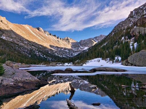
Difficulty: Moderate. Length: 5.2 miles. Elevation Gain: 826 ft. Type: Out and Back. Location: RMNP. More Information: Check it out. Kid friendly.
Shy's very* detailed notes say, "waterfall, lake @ top." The website says: Iconic Mills Lake sits at the top of Glacier Gorge. This route takes you past several popular Rocky Mountain National Park destinations to the serene Mills Lake. You'll pass Alberta Falls and Glacier Falls before reaching the lake. The boulders around the lake are great spots to take a break before heading back to the trailhead.
Chasm Lake Trail
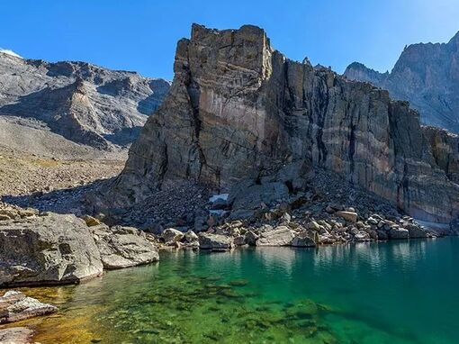
Difficulty: Hard. Length: 8.0 miles. Elevation Gain: 2,552 ft. Type: Out and Back. Location: RMNP. More Information: Check it out.
Start early (like 6AM early), and plan on using between six to eight hours to comfortably finish this one. Lunch, snacks, and the works will be required. Generally considered a challenging route. This is a very popular area for backpacking, camping, and hiking, so you'll likely encounter other people while exploring. The best times to visit this trail are June through October. You'll need to leave pups at home.
The Keyhole & Longs Peak
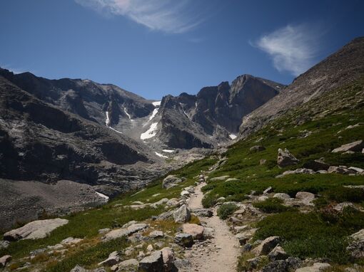
Difficulty: Hard. Length: 13.3 miles. Elevation Gain: 4,934 ft. Type: Out and Back. Location: RMNP. More Information: Check it out.
This is the big one. You'll need the day, and you'll need to scratch it if October feels like winter. Definitely research before you go. Consider going in a group with a trail guide if you're not an avid hiker. We haven't done this one, but hope to ASAP.
Longs Peak is Colorado's northernmost fourteener, and one of the most accessible to the Denver area. It is located in Rocky Mountain National Park in Colorado's front range. Longs Peak is the highest point in Boulder County at 14,259 feet. You won't miss the stark, impressive peak looming above the park.
Longs Peak summit has several routes to the top. All of them are technical and require sections of exposed scrambling. Many require ropes and technical rock climbing experience. The Keyhole route is the most popular route to the top, attracting several thousand climbers during the summer season.